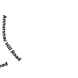
442 ANNURSNAC HILL RD
Owner Information
HADDAD MARK A
442 ANNURSNAC HILL RD
CONCORD, MA 01742


Property Details
442 ANNURSNAC HILL RD is classified as a Single Family Residential (Contemp/modern).
The primary structure on this property was built in 1968. There are 7,360ft2 of built area within this property. There is 2,451ft2 of residential/living space within this property. This property is listed as having 10 rooms.
442 ANNURSNAC HILL RD is valued at $1,077,300. The land is valued at $405,100 and the structures are valued at $660,100. There is an additional valuation of $12,100 on this property.
This property is in Zone AA. Confirm with local Zoning Board authorities to ensure there are no overlays or other easements on this property.
The most recent deed for 442 ANNURSNAC HILL RD is recorded at the local registrar in Book 1338, Page 0007. 442 ANNURSNAC HILL RD was last sold on Friday, May 25, 2007 for $900,000.
Assessment data from fiscal year 2022.
Flood Data
According to the FEMA National Flood Hazard Layer, this property does not appear to be in a flood zone. It may also be in an area not yet reviewed. Nonetheless, confirm this information prior to taking any action.
To view the flood hazards around this property, create a FEMA "Firmette" Map of the area around 442 ANNURSNAC HILL RD.
Broadband Internet Providers
| Provider | Type | Bandwidth (mbps) | |
|---|---|---|---|
| HughesNet | Satellite | 25 | 3 |
| Comcast | Cable | 1000 | 35 |
| Verizon New England Inc. | DSL | 5 | 0 |
| Viasat Inc | Satellite | 100 | 3 |
| GCI Communication Corp. | Satellite | 0 | 0 |
| Concord Light Broadband | Fiber | 300 | 300 |
| VSAT Systems, LLC. | Satellite | 2 | 1 |
| T-Mobile | Fixed Wireless | 25 | 3 |
Broadband service provider data from December 2020.
Adjacent Properties
- 976 BARRETTS MILL RD
Dept. of Corrections (DOC) - Division of Youth Services owned by COMMONWEALTH OF MASSACHUSETTS - 430 ANNURSNAC HILL RD
Single Family Residential owned by HILTON PETER D - 466 ANNURSNAC HILL RD
Single Family Residential owned by REDMOND SHAWN M - 40Y ANNURSNAC HILL RD
Vacant, Selectmen or City Council (Municipal) owned by TOWN OF CONCORD - 508 ANNURSNAC HILL RD
Single Family Residential owned by OSTRONIC, TRISTAN NICHOLAS - 518 ANNURSNAC HILL RD
Single Family Residential owned by BROWN RICHARD N